
Streetwise Wildemanbuurt
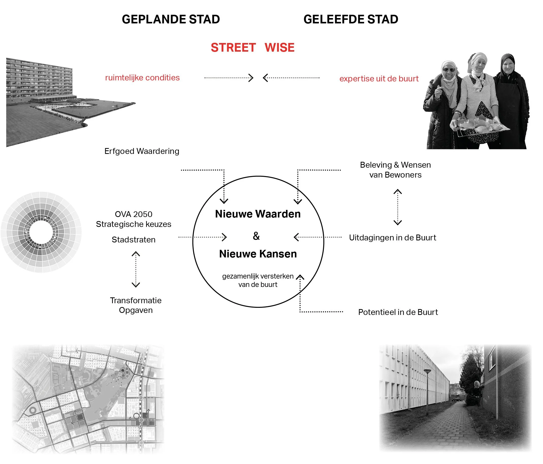
A design research project that seeks to define how to reconcile the “planned city” and the “lived city”. Is it possible to define shared values in and with the neighbourhood which can form the basis for future transformation strategies?
Wildemanbuurt and Blomwijker are two neighbourhoods situated to in the north east corner of Osdorp in Amsterdam New West. The neighbourhoods urban design and architecture represent a high point in Dutch Modernism. Their design was part of the 1935 Amsterdam extension plan designed by Cornelius van Eesteren, laid out to the ordered CIAM principles for modern town planning. New residents were offered large comfortable homes with all the modern conveniences, generous open spaces with well-designed amenities for sport and play, local shops and schools were within walking distance. Altogether this created a self-contained neighbourhood unit which was much loved by the first residents that moved into the district.
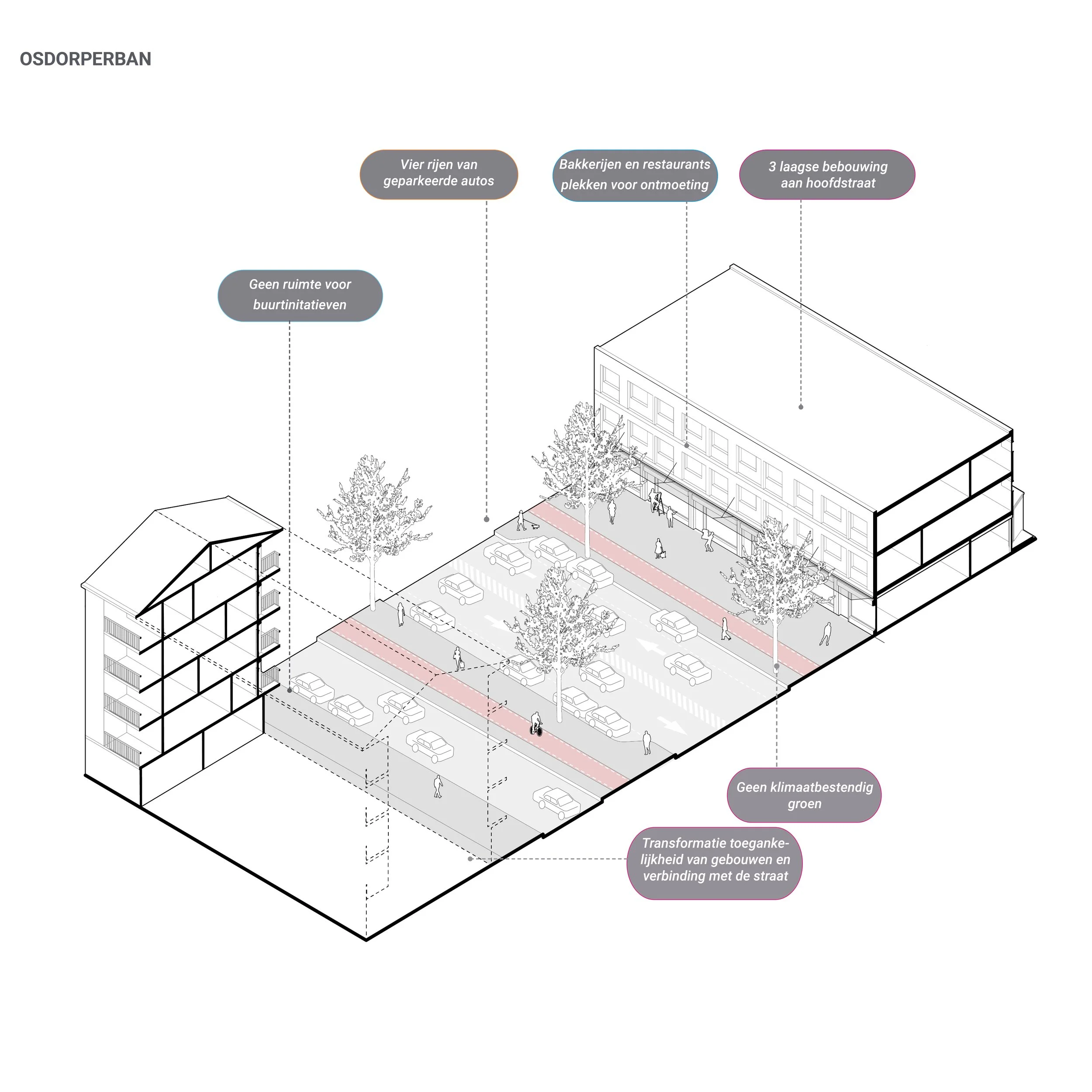
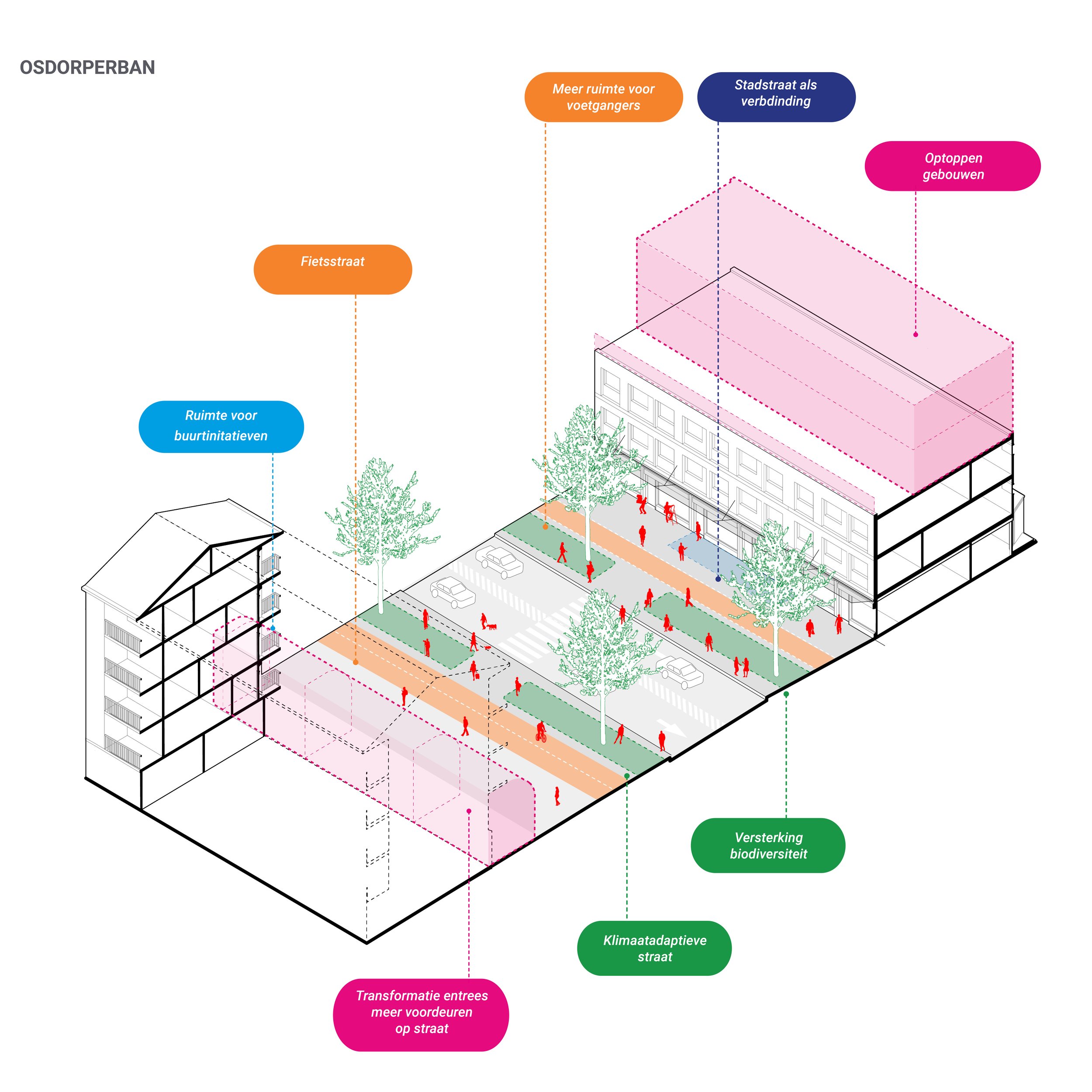
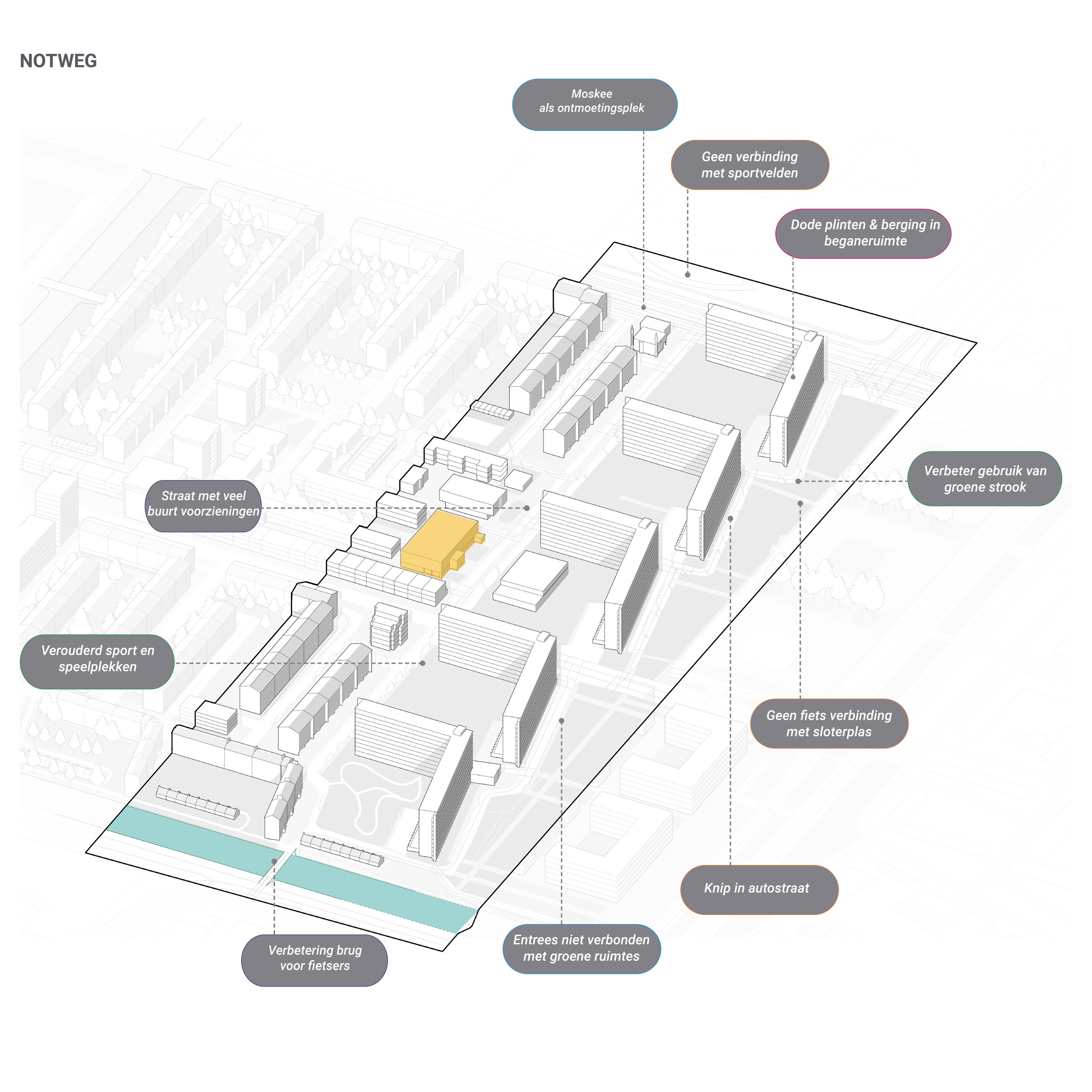
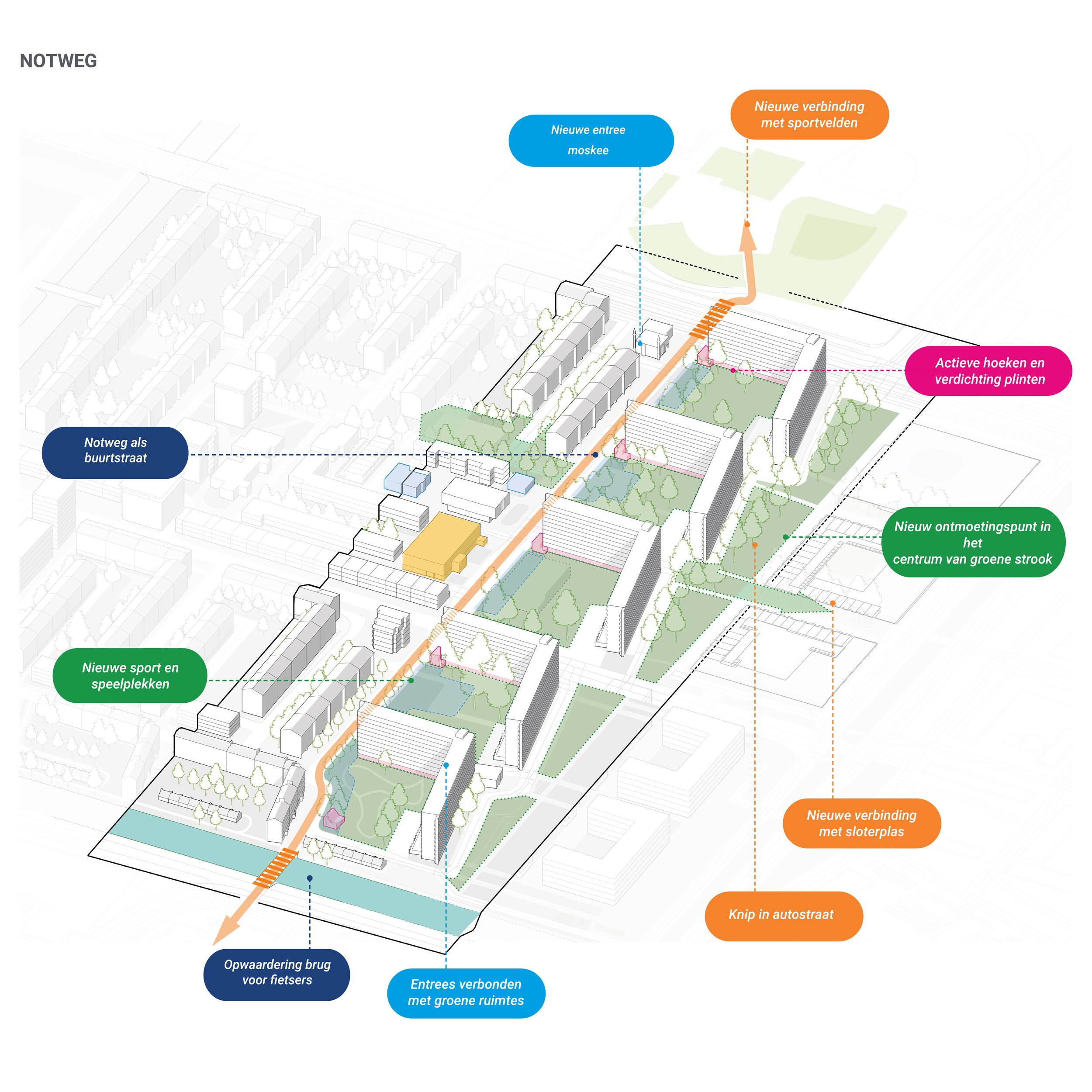
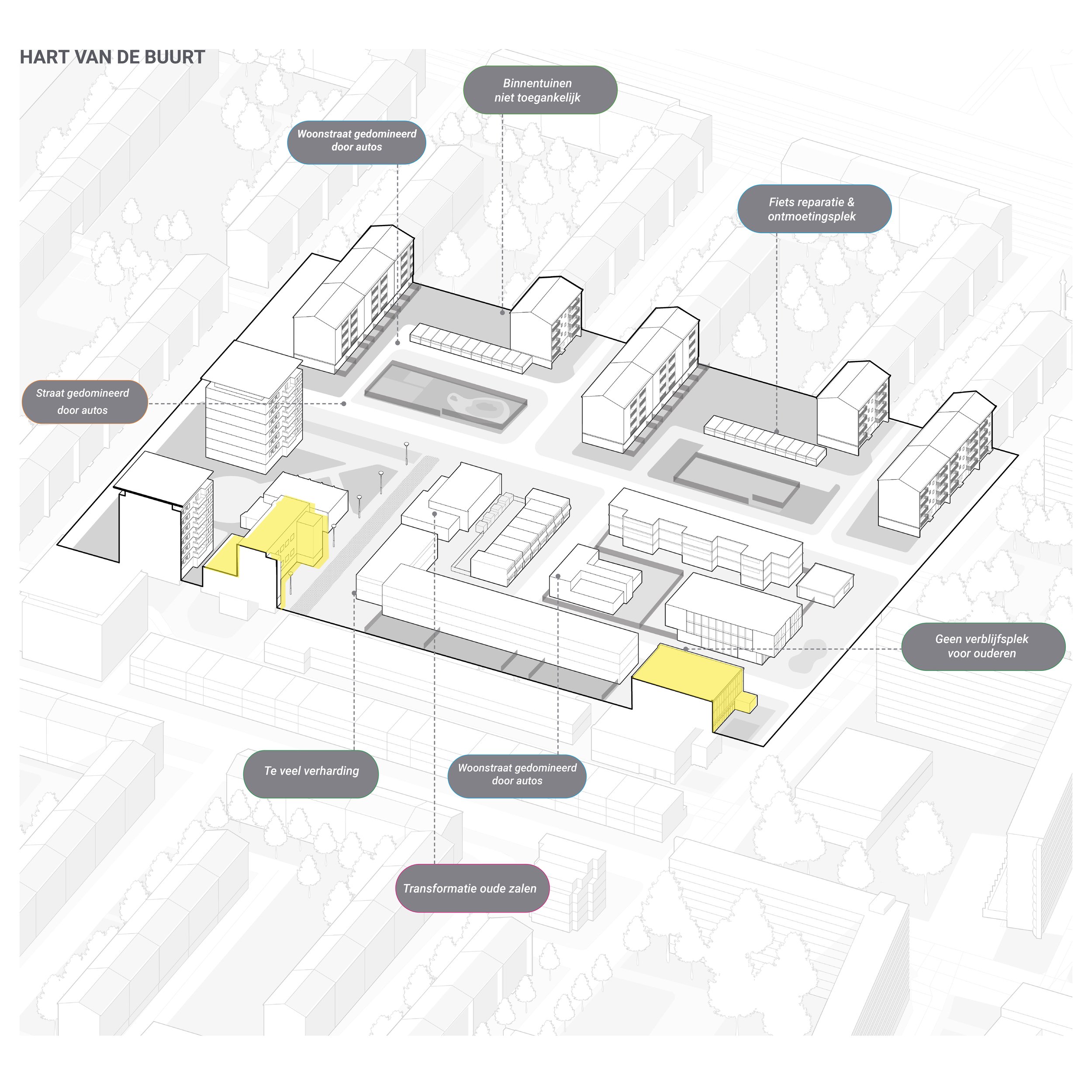
After 60 years the neighbourhoods have changed significantly, the original openness and clarity of the public spaces has been erased, primarily due to the increased parking demand in the neighbourhood. Next to this many of the original buildings have deteriorated and do not meet todays standards. In 2009 a full-scale redevelopment plan for the neighbourhoods was postponed and then cancelled leading to a lack of investment by the housing corporations in the basic maintenance of the dwellings.


This research-by-design project sought to bridge the gap between the longer term larger-scale municipal strategies “the planned city” and the short-term everyday needs of the residents “the lived city”. The project seeks to connect residents everyday experiences of the neighbourhood - often negative regarding the spatial fabric but positive regarding the social fabric - with the large scale ambitions found in the Amsterdam City Development Plan.
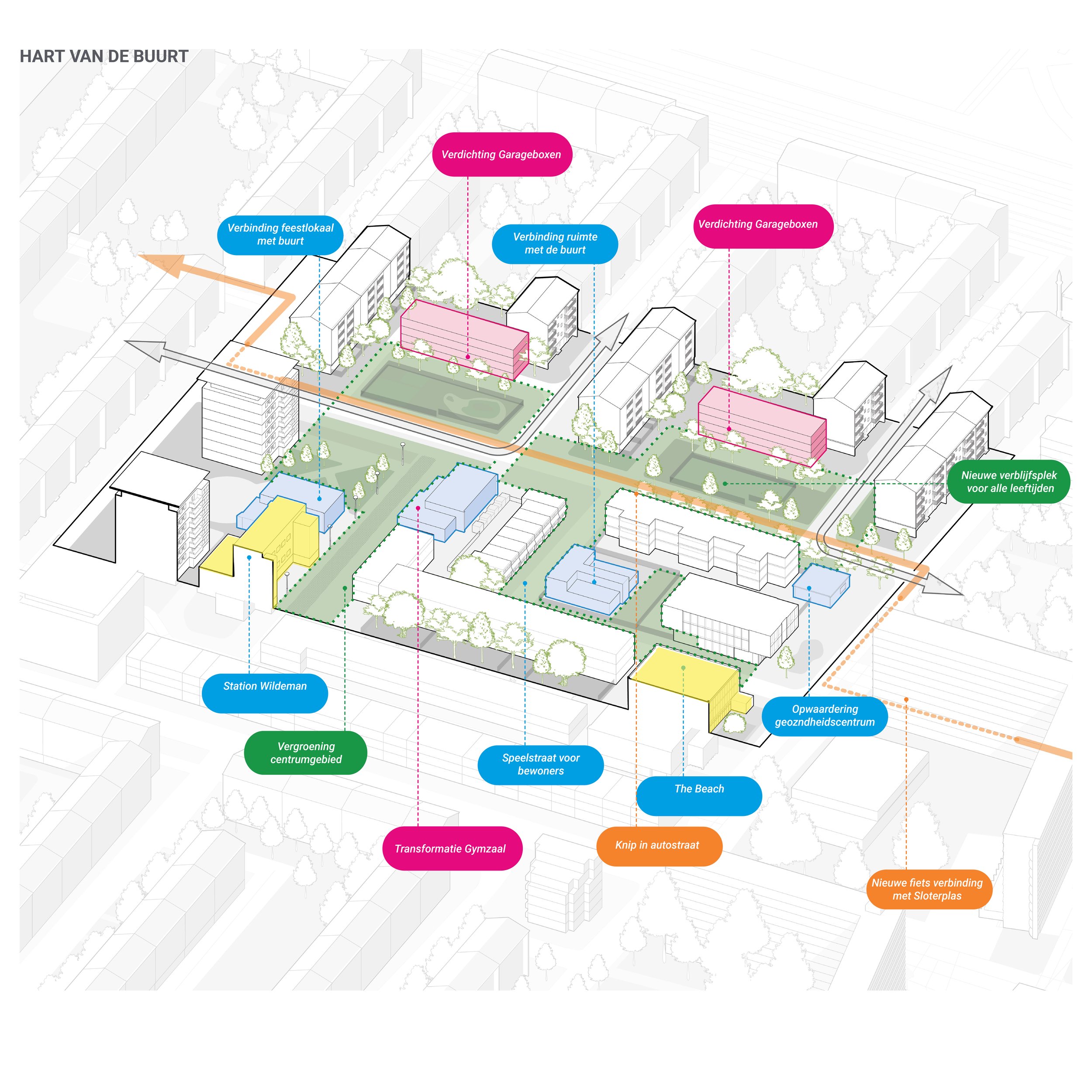
The proposed approach develops a tool for assessing the different values and how to plan and implement long and short term improvements to the neighbourhood to overcome the inertia of cancelled redevelopment projects and the neighbourhood falling into further disrepair.
A radar diagram brings the five strategic choices from the Amsterdam 2050 Development plan together. These strategies are then used as a basis for consultation on a neighbourhood scale. We chose three locations that were representative of the different street profiles from the original AUP masterplan. At each of the locations the current problems were defined and future improvements proposed.
Connecting the planned and the lived city
The project was funded by the Dutch Creative industry funds under the Vitale Steden en Dorpen Open Call. Which fell under the larger VRO funding scheme which sought to address major societal challenges in The Netharlands over the next 30 years the goal being to boost the use of spatial design in tackling these tasks and encourage an integrated approach.
The final results were published in a book titled Transities available here for download. The approach in Streetwise Wildeman was selected as a key project for publication in the book.